Introduction to Fitzmaurice Flying Field Massapequa
The area of Massapequa north of Sunrise Highway boasts a rich history, significantly transformed since its mid-19th century settlement. After World War II, this area experienced radical changes, a fact many long-time residents can attest to. Among its unique features was the Fitzmaurice Flying Field, a small airport that existed from 1929 to 1953 in what is now Massapequa Park.
The Birth of Fitzmaurice Flying Field Massapequa
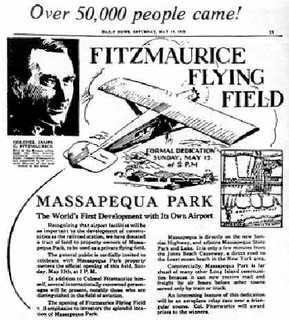
In 1929, three Irish lawyers—Brady, Cryan, and Colleran (BCC)—opened the Fitzmaurice Flying Field in Massapequa Park. These developers saw potential in the area north and south of Sunrise Highway for real estate development. Their plans were influenced by then-New York Governor Alfred E. Smith, who informed them about Robert Moses’ plans to build highways nearby, enhancing accessibility.
Development Vision of BCC
The firm BCC capitalized on the sparse settlement of the area and the lingering anti-German sentiment from World War I. They marketed the area to Irish neighborhoods in New York City, highlighting their Irish heritage. By 1927, they had begun promoting their development plans, including the establishment of an airport.
Location and Layout of Fitzmaurice Flying Field Massapequa
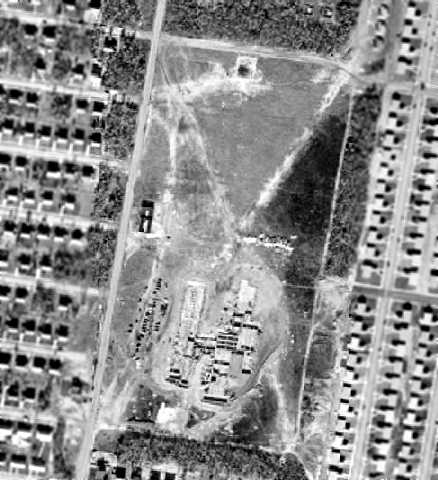
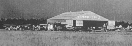
With the help of famous aviatrix Elinor Smith, BCC selected the airport’s location. Fitzmaurice Flying Field was situated between Second Avenue, Roosevelt Avenue, Spruce Street, and Smith Street. Covering 21 acres, it had two runways, the longer one being 1,800 feet. Despite its small size, the developers marketed the airfield as a major asset for affluent residents who might own planes.
Grand Opening of Fitzmaurice Flying Field Massapequa
The airport opened in May 1929 with great fanfare. The event attracted a large crowd and notable aviators like Clarence Chamberlain, Bert Acosta, Thea Rasche, Elinor Smith, and James Fitzmaurice. Fitzmaurice, after whom the field was named, was celebrated for his achievements, including a pioneering east-to-west transatlantic flight in 1928.
The Impact of the Great Depression
The onset of the Great Depression in 1929 drastically affected the development of Massapequa Park. The stock market crash led to a decline in property sales and financial hardship for homeowners. BCC exploited these conditions, leading to legal issues and the eventual downfall of Cryan and Colleran, though Brady remained unscathed and later became Massapequa Park’s Chief Judge.
Evolution of Fitzmaurice Flying Field Massapequa
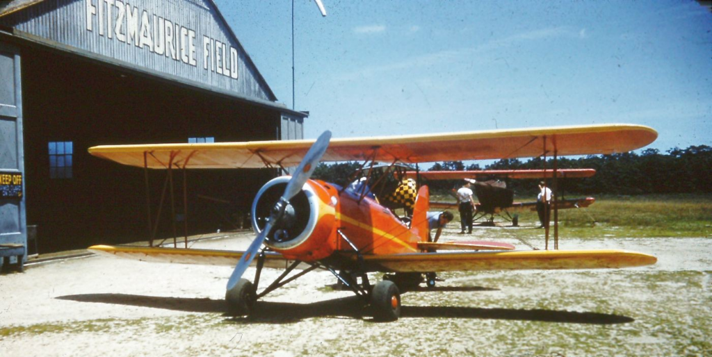
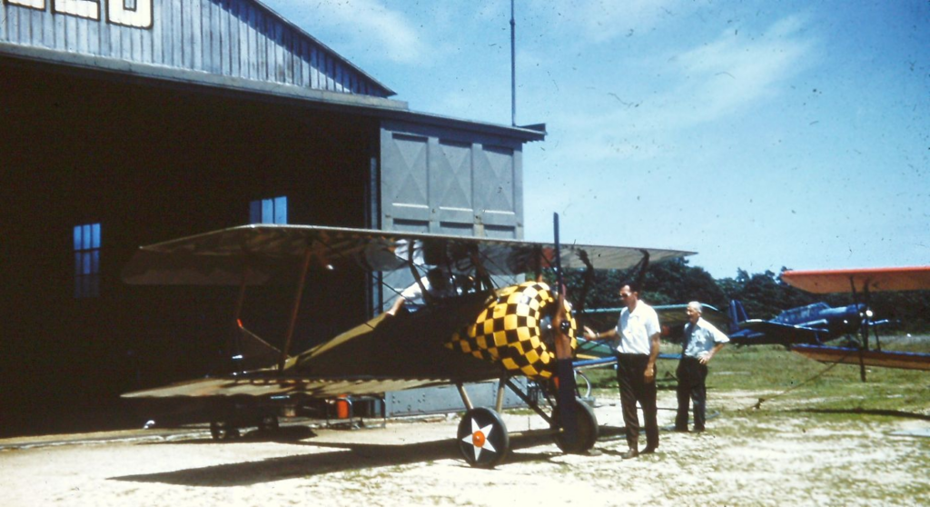
By the late 1930s, Fitzmaurice Flying Field had shifted its focus. Managed by Tom Murphy, it became a training facility and a base for skywriting. However, the post-war housing boom in the 1950s raised safety concerns due to the increasing number of homes near the airfield.
Sale and Repurposing of Fitzmaurice Flying Field Massapequa
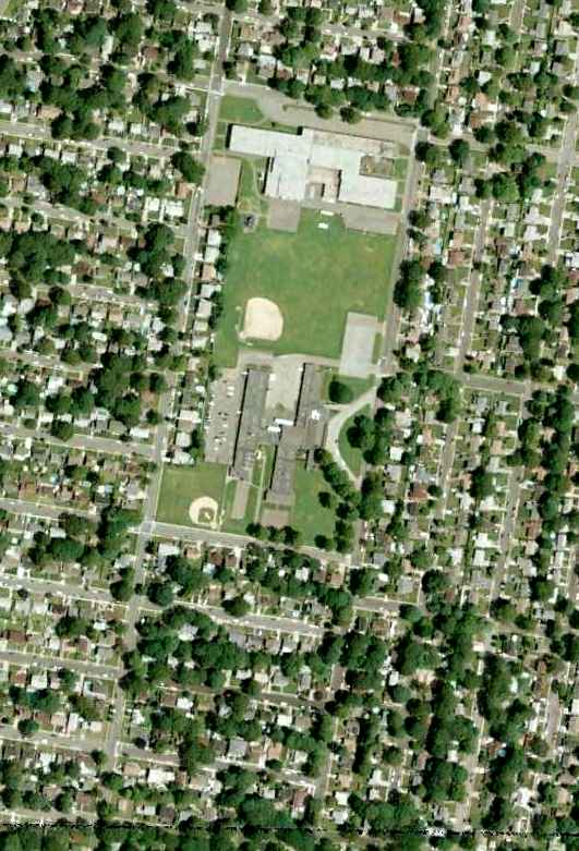
In 1953, Tom Murphy sold the Fitzmaurice Flying Field property for $600,000. The hangars and other structures were demolished, making way for new developments. Hawthorn School was built on the southern part of the field in 1954, and McKenna School followed in 1958. Hawthorn School later became the Nassau County Police Training Academy.
Commemoration by the Historical Society
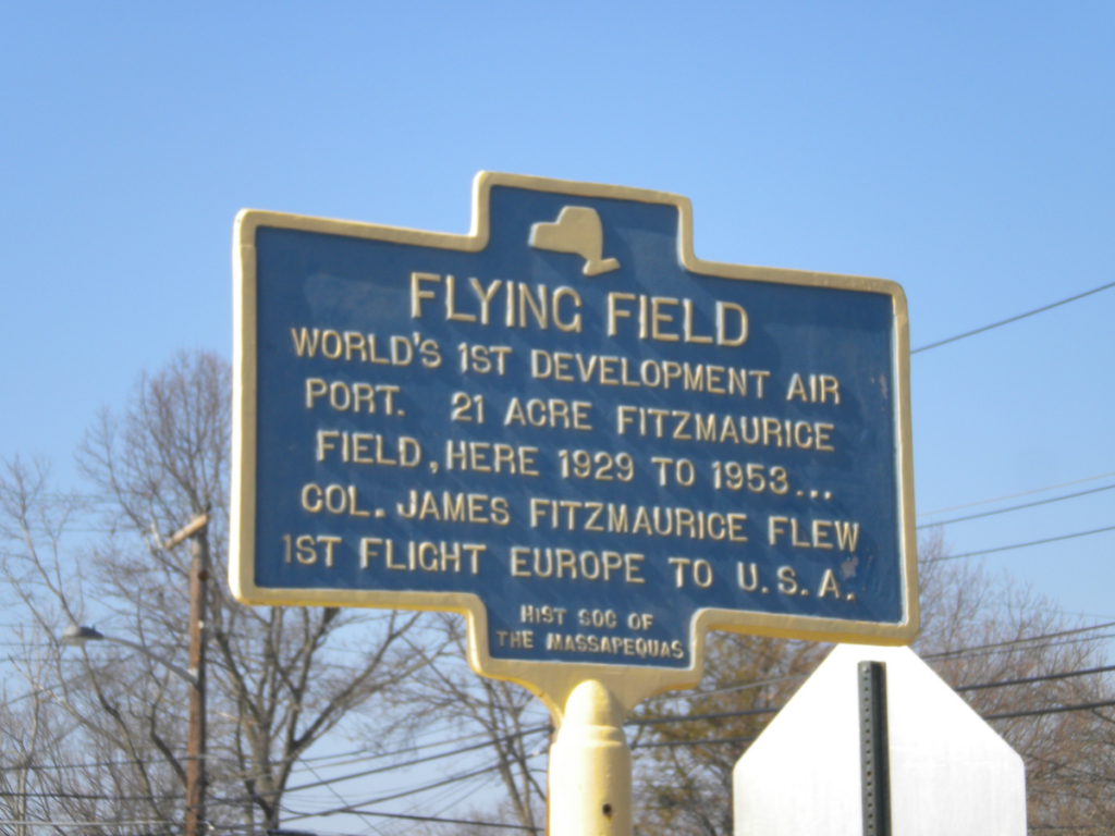
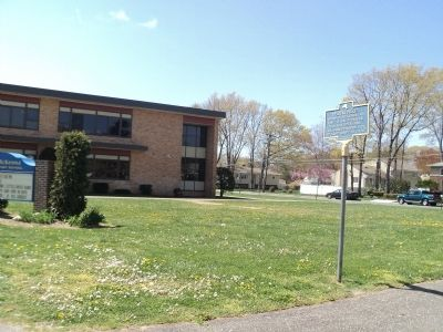
In 1995, the Historical Society of the Massapequas recognized the significance of Fitzmaurice Flying Field Massapequa by erecting a marker on Spruce Street, just east of Roosevelt Avenue. This dedication, arranged by Society President William Elio, serves as a reminder of this unique chapter in Massapequa’s history.
Conclusion
Fitzmaurice Flying Field Massapequa holds a special place in the local history. From its ambitious beginnings by BCC to its transformation into educational institutions, the story of Fitzmaurice Flying Field Massapequa reflects the dynamic changes in the area north of Sunrise Highway. This historical landmark remains a testament to the region’s rich and evolving heritage.
Present Day
Present Day, the land where Fitzmaurice flying field previously occupied is known as Mckenna Elementary School. You can see photos below of the landmark sign representing the site of the flying field.